
Churachandpur


India is full of secret tourist destinations and today we are discussing about Churachandpur, which is also known as Lamka. This small town is located in Manipurwhich people also designate as Switzerland of India. Churachandpur is spot having natural beauty areas, though city was used for commercial purpose by the diverse rulers of Manipur. Export of countless products is done to international market from Churachandpur. The town faced difficulties during World War II when Japanese Army bombarded the town. However, city enjoyed the peace and clam for more than 5 decades as not much rulers came to town. After WW II particularly in 1970s and 80s, the town was declared as most peaceful island on earth. Today list of big investors is available started industries and several commercial plants in Churachandpur.


Attraction in Churachandpur:
Tipaimukh: a heritage spot where travelers can attain is Tipaimukh. It’s a meeting area of River Tuivai and River Barak with astonishing surroundings. Tipaimukh is made of two words Tipai and Mukh. However, the place is top location for picnic in Churachandpur.


Khuga Dam: Rivers in town are ever flowing and a big dam is constructed on Tuivai River known as Khuga Dam. Dam is located in south direction of Churachandpur and its inauguration was done by President of Congress Party Smt. Sonia Gandhi in late 2010. Dam is newly constructed hence the surrounding areas are beautiful constructed and managed by local administration of Manipur.  Reason behind building the Khuga Dam was to supply the electricity to nearby areas and also provide the ample quantity of water to closer locations particularly for farming.


Ngaloi: with few kms people can attain a small village Ngaloi located nearer to Churachandpur city.  Low laying hills and greenery surroundings are best things to watch in Ngaloi town. High pressure flowing waterfall is more famous of Ngaloi, though height of fall is not much but the pressure is good enough.
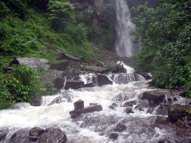
People love peace and want to relax their mind pressure can attain to Churachandpur as the city is having complete greenery everywhere and surrounding locations are beautiful too. However, attaining to city in rainy season could be little difficult because Churachandpur face heavy rainfall every year.


Attaining to Churachandpur:
By Air: domestic airport of Tulihal is available for the voyagers. The distance between Tulihal and Churachandpur is only 60 kms and taxi service from outer area of airport is available for Churachandpur.

By Rail: Churachandpur is not having any railway station, though Indian railway is preparing projects to connect the town with major parts of India. Big rail hubs close to Churachandpur are Guwahati and Dimapur.

By Road: NH 150 is passing from Churachandpur town and road is named as Tipaimukh Road in Manipur area. People can reach to Mizoram by passing through Churachandpur and the mostly route of NH 150 is adventurous and full of greenery. People can also go through Teddim Road which links the city Imphal with other states and cities of India.

Popular posts from this blog

Amarkantak - A Worship Place of Madhya Pradesh

A majestic place of Madhya Pradesh is our next tourist destination. Amarkantak is the small city situated in the middle area of superb ranges Satpura and Vindhya. The average elevation of this city is 1065 meters. The charming weather and best valleys with amazing view makes this place first choice for nature lovers. Amarkantak wraps up the splendor of typical sylvan atmosphere. The 2 best rivers of India known as Narmada and Sone are flowing from this area.  Word Amarkantak comes from Sanskrit language that is related to mythological meaning. Because of religious values this place is also known as Theertha Raja (King of Holy destinations). The Narmada River is having holy values for Indians.  It’s a land of great history holding story of diverse empires. Pandavas also ruled this place for short period.  Amarkantak is added in the list of usual heritage zone. It’s full of dense forest with huge valleys.  When we talk about the spots for travele...

Somasila Dam: A Hidden Gem in Nellore District

This is a fantastic breakdown of one of Andhra Pradesh’s most underrated gems. Somasila isn't just a wall of concrete; it’s where engineering shakes hands with the soul of the Eastern Ghats. I’ve rewritten your content into a high-energy, "travel-mag" style that highlights the drama of the landscape and the peace of the reservoir. Somasila Dam: Where the Penna River Meets the Heavens 🌊⛰️ Forget the crowded tourist traps. If you’re looking for a destination that balances massive scale with pin-drop silence, Somasila Dam in Nellore is your next coordinates. It’s not just the largest reservoir in the Penna River basin—it’s a 212-square-kilometer mirror reflecting the majesty of the Eastern Ghats. The Vibe: Engineering Marries Nature The "Can't-Miss" Experiences The Spiritual Shift: Visit the Sri Someswara Temple . It was heroically relocated to higher ground to save it from the rising reservoir waters. Today, it stands as a sentinel of peace and a must-v...

Majuli - Largest River Island of India

A small island of Assam known as Majuli is our next Indian tourist place. The other name of this island town is Majoli popular as one of the largest river islands of India. It is located on Brahmaputra river the big and every flowing heavy river of India. If we go through the list of largest rivers islands of the world then Majuli stands on 24th position. It was spread in area of 1250 sq kms that is equal to 483 sq meters. However, the area of Majuli was reduced to 421.65 sq kms because of erosion occurred in 2001.  Formation of this island was done by the Brahmaputra River, though its north part is connected with Subansiri River. To access Majuli island people can get the ferries from Jorhat City. This island is 200 kms far from largest city Guwahati.  Majuli is popular for breathtaking scenic beauty. Here in this island there are two villages known as Kamalabari that is located at only gap of 3km and Garamur situated at 5km distance in north. Kamalabari is ...